The missing elevation app for iOS
Elevato is your essential iOS app for tracking current elevation, saving favorite high points, and calculating long-distance visibility like never before. See your elevation instantly with dynamic backgrounds that change with your location – from mountain vistas high up, to serene beach fronts at lower levels. Keep track of your personal records and explore the world's vertical dimension.
What's new in v2.0
A major update packed with new features and improvements.
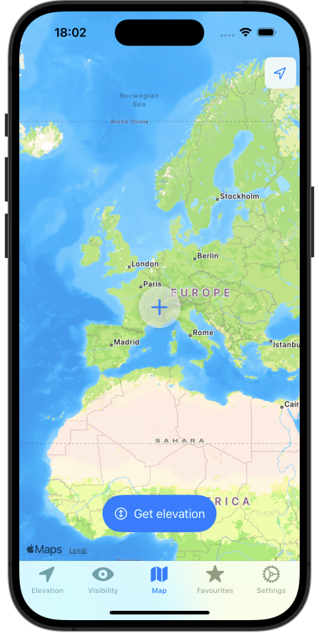
Dual map support
Choose between Apple Maps and Elevato Maps for your preferred mapping experience.
Location search
Search for addresses and places directly on the map.
Elevation history
Browse your past elevation records and track your journey over time.
DEM-confirmed elevations
GPS elevations are verified against Digital Elevation Model data for improved accuracy.
iCloud sync
Your settings and preferences sync automatically across all your devices.
Map caching
Cache map tiles for faster loading and manage storage in settings.
Layer controls
Toggle terrain, hillshade, labels, and other map layers to customize your view.
Elevation badge
See your current elevation right in the tab bar at a glance.
Performance boost
Faster app startup, smoother animations, and improved map responsiveness.
Never lose track of your elevation
No ads, no subcription
- Simply, no ads, never.
- No subscription needed.
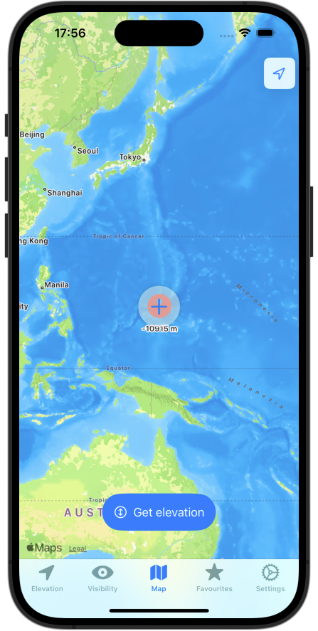
Arbitrary elevation view:
- Select any point on the globe to see its elevation.
- Works on oceans and poles as well.
- Elevation is provided by our backend server using high resolution dataset from Copernicus dem-30m program (for land) and Gebco (for oceans).
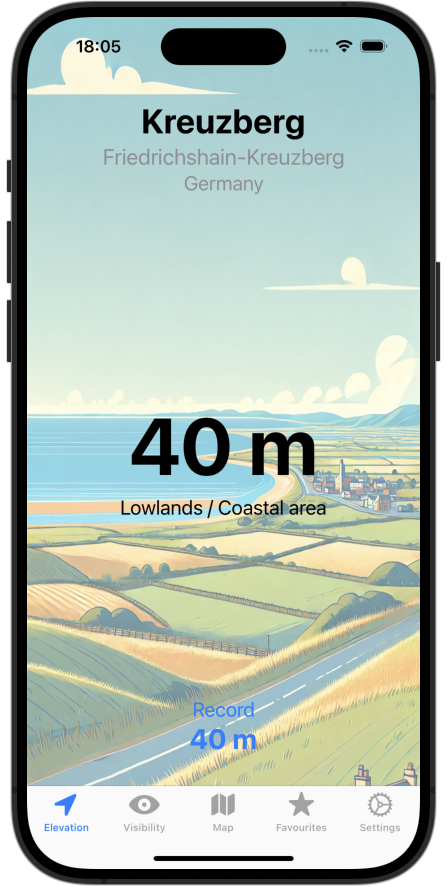
Current elevation view:
- Instantly see your current elevation, save it for later.
- Beautiful backgrounds reflect your current height.
- View your highest elevation record & location.
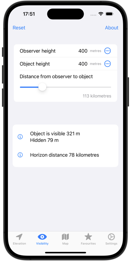
Line of Sight tool
- Check if one location is visible from another using real terrain data.
- Accounts for Earth's curvature and atmospheric refraction.
- See blocking terrain, near-misses, and curvature metrics.
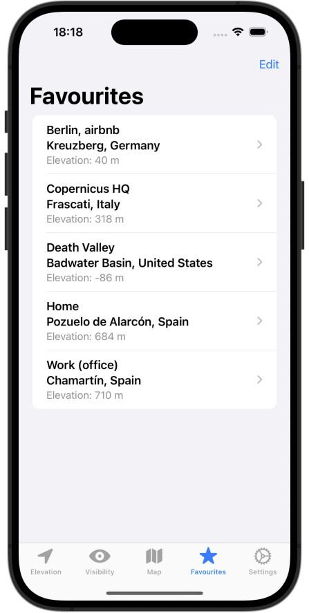
Save & manage favorite spots:
- Save current elevation as favourite.
- Compare favourites and use them as base for visibility calculations.
.. and more:
- No tracking: App works without location permission and even with permission on, your location never leaves the device.
- iOS exclusive: Not available on android or other fake phones.
- Fully translated to: Spanish and Finnish, besides English.
Line of Sight: See what's really visible
Determine if a distant location is visible using real terrain elevation data. The tool accounts for Earth's curvature and atmospheric refraction. Perfect for hikers, photographers, and explorers!
How it works:
- Select observer (Point A) and target (Point B) locations on the map.
- Terrain is analyzed using Copernicus DEM data (30m global, 2m in select regions).
- See if the line of sight is clear or blocked by terrain.
- View curvature metrics: horizon distances and hidden/visible heights.
Identify blocking peaks, near-misses, and the point where your sightline escapes to space.
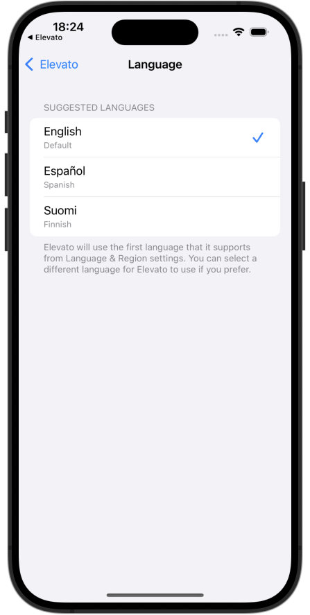
Choose your language
Elevato speaks your language. Whether you're hiking in the north, navigating the Canary coasts, or just curious at sea level — we've got you covered.
- English – default language
- Finnish – täysi tuki suomalaisille käyttäjille
- Spanish – soporte completo para exploradores hispanohablantes
Make elevato yours
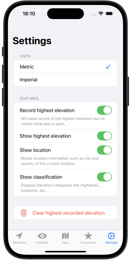
Units choice
Switch easily between imperial (feet, miles) and metric (meters, kilometers).
Highest record
Toggle recording, display, or reset your highest achieved elevation.
Learn more
Quickly visit elevato.app directly from the app's settings.
Take a look inside elevato
Get in touch
Have questions, feedback, or suggestions for Elevato? We'd love to hear from you!